Garmin devices with navigation and connects to Basecamp and turf zones

Post Reply
User avatar
deppen
Posts: 107
Joined: 04 Jul 2019 08:11
Country: Sweden

Garmin devices with navigation and connects to Basecamp and turf zones

Post by deppen »

I use my Edge 1030plus and my Fenix 5x to see or navigate to turf zones .
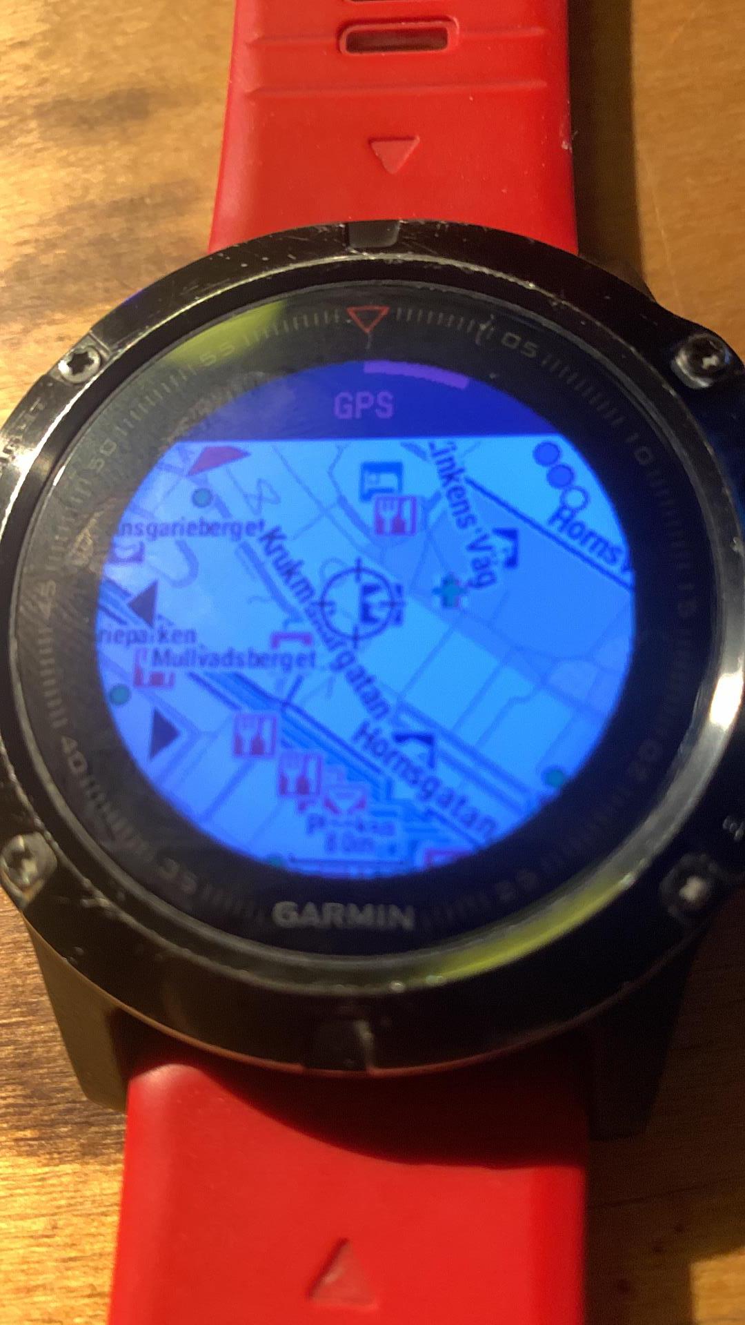
About the fenix 5x just because its possible, and i like to test things.
Each device have a slightly different way to add turf zones.

A tool you will need https://turf.urbangeeks.org/
Use that map to download selected turfzones as a gpx file import that file to basecamp.
To see all zones in a region in Basecamp and your Garmin device select your region in https://turf.urbangeeks.org/

To use that GPX file in Edge use this tool https://www.javawa.nl/rtwtool_en.html to convert the downloade gpx file to a garmin gpi file , you can also choose a icon for the zones, i use a red figure :)
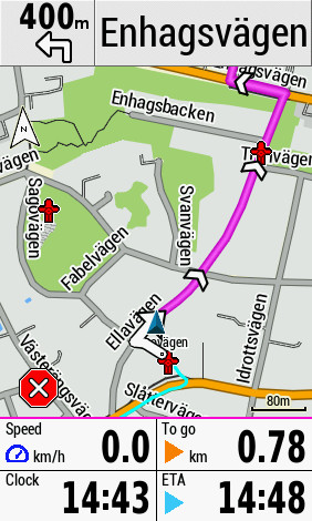
For the edge 1030+ connect it to your pc, go to garmin folder create a folder called POI , copy paste the GPI file to the POI folder.
Now you will see zones on the map in your edge 1030+ , may have to zoom in a little though , fully zoomed out doesnt show them.
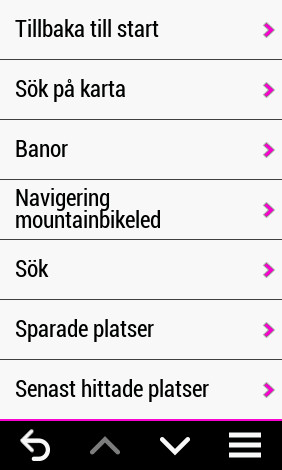
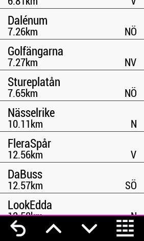
You will also be able make a route to any of those zone in search / extras , however screen is blank but press the down right list and type in zone name or start of a zone name you will get a list. Its neat

About the fenix 5x this work aswell BUT you will need to use garmins POI loader https://www8.garmin.com/support/downloa ... jsp?id=927
You can also make your own icon for that file, instructrions how is in Garmins help sections, i lost that link though :/
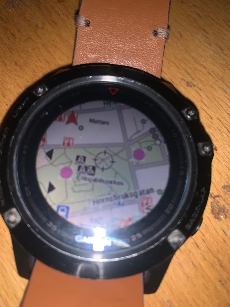
I just made pink ball for easyness to see it on the Fenix 5x


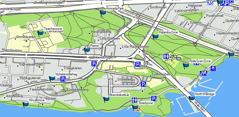
Currently i have 6000 + zones in my Fenix 5x and on my Edge 1030+ 6498 . The red men is turf zones and you see my route, in sunlight its great :)
Image

I add pictures from Fenix 5x and basecamp
Image
Image
User avatar
deppen
Posts: 107
Joined: 04 Jul 2019 08:11
Country: Sweden

Re: Garmin devices with navigation and connects to Basecamp and turf zones

Post by deppen »

How i use this, once a month i download the region again as GPX ,due to new zones that have appeared , and import to basecamp.
For edge 1030 i convert the GPX file with the JaVaWa RTWtool to a garmin POI file *.gpi

During month i add unique zones or zones i want to visit as saved location as its easier remember them and see.
Edge have a limit of 1000 , as a saved location.

How it looks Sök - search and Sparade platser - saved locations
Image

Sparade platser is limited to 1000 and i have fewer ofcourse , mostly Warded green, and uniques :) clicking sparade plataser shows the list.
Image

in Sök click extras and there you will see a blank screen or folder names if blank just click the down right search icon and type start of or full zone name . in the created garmin/POI fodler you can create folders for what you need , for an example regions you visit regulary.
It can look like this.
Image

The numbers is just so i know how many zones it is in each region and i replace once a month , and more zones is added then.
As you see this way i bypass the saved location 1000 limit.

This works with edge 530 as well, but mine broke , but i was fully paid back due to warranties.
Besides that a touch screen is a lot more handy for using the Edge map as i do , Fenix 5x is well lot of clicking on the buttons.

Any other Garmin device i have no knowledge of how to do this on them.

Once i visit a zone a 2nd time i delete it from Sparade platser- saved locations , but it will remain in Sök-Search , extras .

Im curious if this been helpful :)
Post Reply

Return to “Third-party”